
Latest News
Hey everyone! We hope you find our coverage of the Lycian Way helpful in your trip planning. On this site you’ll find details about the overall trail, individual trail sections, entries for each community, plus listings of most water sources and wild campsites. There are lots of articles with background info on the Lycian Way, details on accommodations, and more. We’re slowly adding other details as well.
We’re still preparing our GPS tracks / waypoint data files. Those should be available soon (hopefully!). We’ve added a couple hundred photos to the site so far, but many more are still to come.
Feedback on our content is highly welcomed! If you have any comments about the site, suggestions on how to improve it, or questions about the trail, contact us directly at feedback@trekopedia.com – we’d love to hear from you!
FYI, this site is totally non-commercial. We don’t charge anyone to be listed or mentioned. There’s no advertising or other nonsense. We do this to give back to the community for all the help we’ve received over the years. If you’d like to help as well, send us feedback from the trail and we’ll include it here for others.
Metrics
Select the tab below corresponding to the direction you plan to walk.
Towards Antalya (eastbound):
Towards Fethiye (westbound):
Nitty-Gritty
Orientation
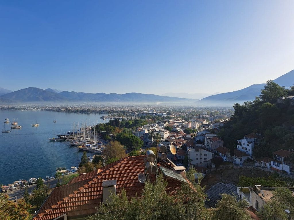
Fethiye (small city)
Geyikbayırı (village near Antalya)
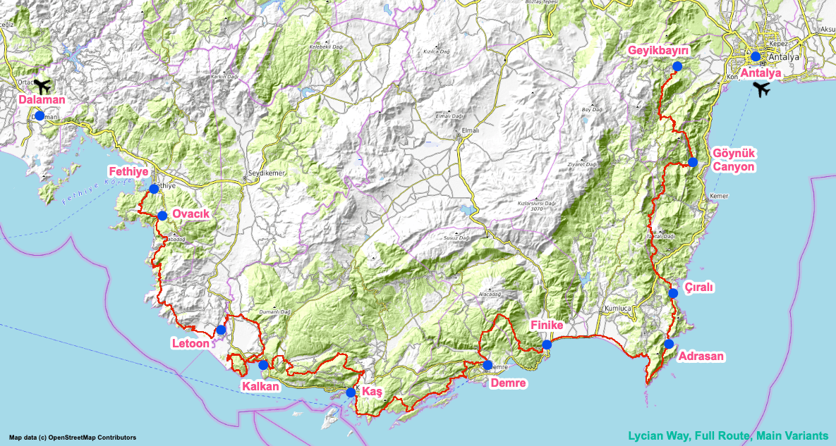
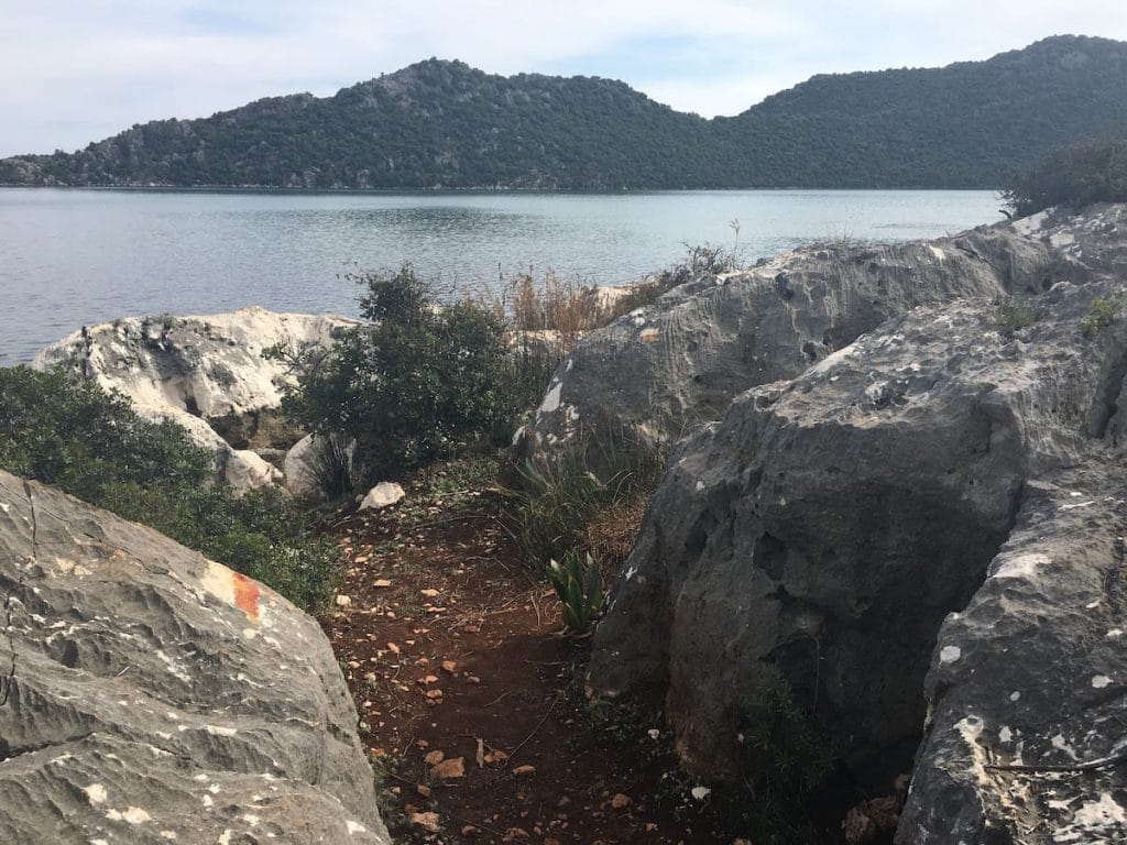
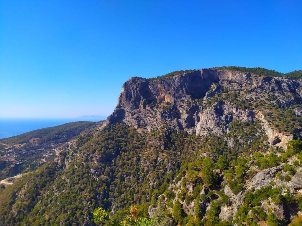
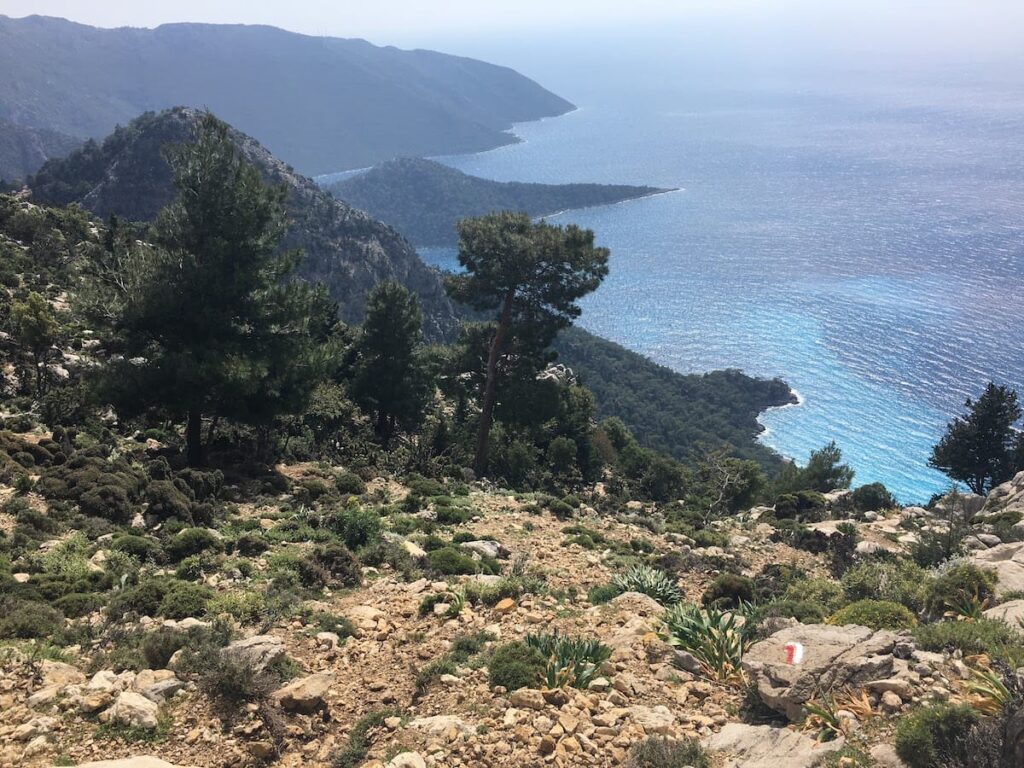
Roughly a west-east trail, with a bulge to the south as it wraps around southern Turkey’s famous Turquoise Coast, generally following the mountainous coastline.
The official western endpoint is actually in the town of Ovacık though most hikers just start in Fethiye (a waymarked trail connects Fethiye with Ovacık, passing through the village of Kayaköy with its interesting ‘ghost town’ ruins).
Towns: In addition to the endpoints, it passes through the towns of Kalkan, Kaş, Demre, Adrasan, Çıralı, and many remote villages.
Direction: Can be done in either direction, though most seem to do it west-to-east.
Challenges
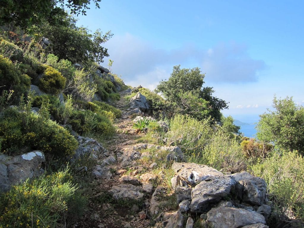
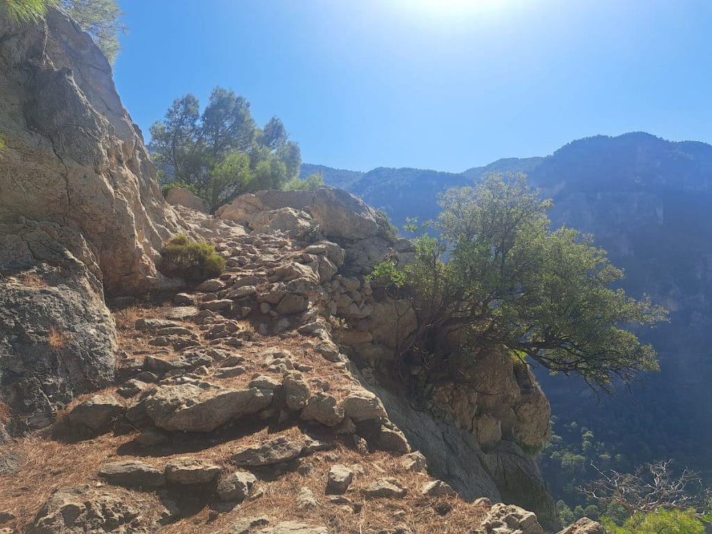
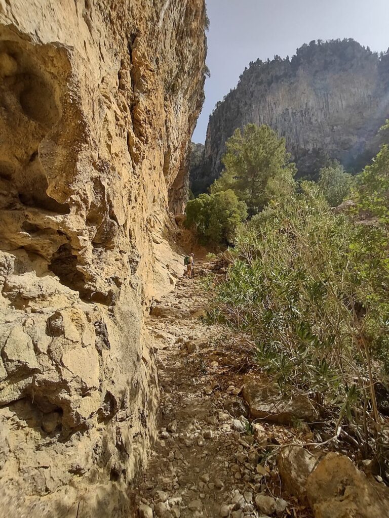
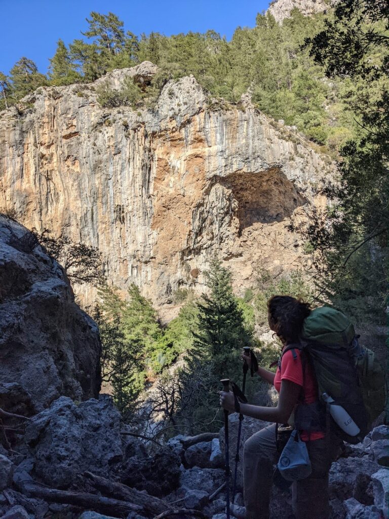
Difficulty: Moderate, mainly due to the constantly changing elevations and the rocky trail surface. Suitable for most reasonably fit hikers.
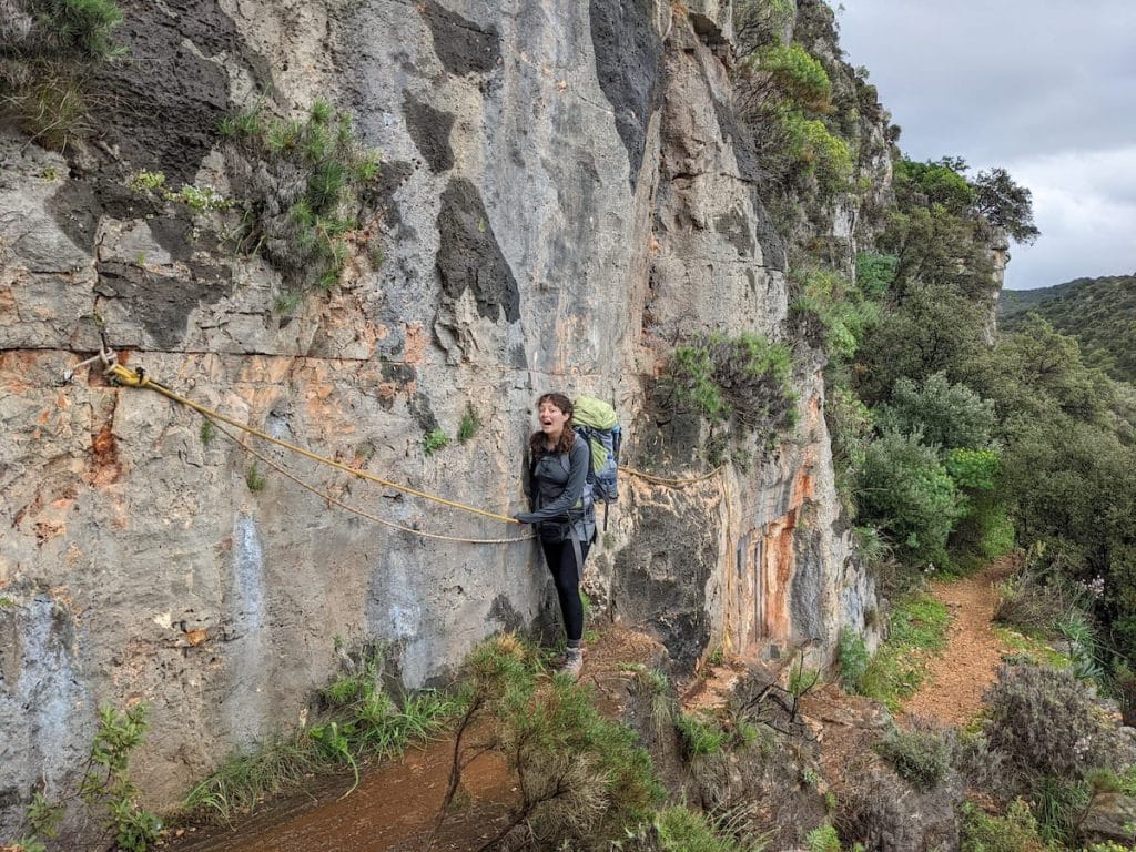
Heights: Those with a fear of heights might want to look elsewhere as the trail is frequently on steep inclines or near cliff edges.
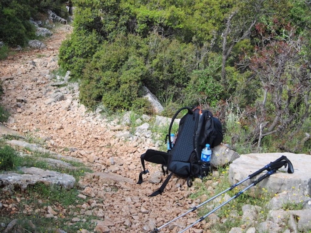
Technical Skills Required: None. Just energy, endurance, and a decent sense of balance.
Heights: Those with a fear of heights might want to look elsewhere as the trail is frequently on steep inclines or near cliff edges.
Technical Skills Required: None. Just energy, endurance, and a decent sense of balance.
Trail Network
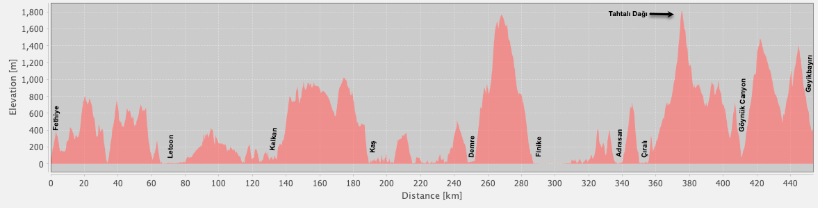
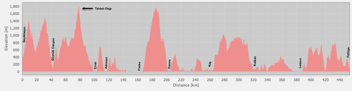
The Lycian Way consists of approximately 508 km / 316 mi of way-marked trails. However, a chunk of that are alternate variants meaning that a full-trail hike is roughly 450 km / 280 mi depending on which variants you choose.
We also track more than 180 km / 112 mi of additional, unofficial, paths that might be of interest. These include popular alternatives that are way-marked but not part of the Lycian Way itself, plus some shortcuts and various road options that might be useful to bypass portions of the trail where desired.
We also track more than 180 km / 112 mi of additional, unofficial, paths that might be of interest. These include popular alternatives that are way-marked but not part of the Lycian Way itself, plus some shortcuts and various road options that might be useful to bypass portions of the trail where desired.
Seasonality
When: Can be hiked year-round.
Recommended: March to May and Sept / Oct tend to be the best months, due to milder temperatures.
Alert: The summer months can be hot (often extremely hot!), especially at lower elevations. Winter hikes in the mountain sections should only be undertaken by those who are experienced in such conditions.
Suitability
This is a hiking-only trail due to frequently-rugged, uneven terrain and many narrow footpaths.
Cycling: While the official trail is hiking-only, it would be easy to bicycle along the general route of the Lycian Way using nearby rural (low traffic) roads. You’d still be able to reach almost all attractions along the route and would enjoy many of the same excellent sights and experiences.
Camping is optional but not required.
Highlights
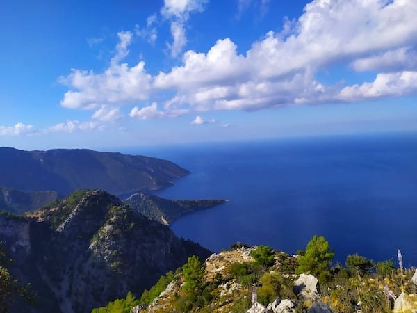
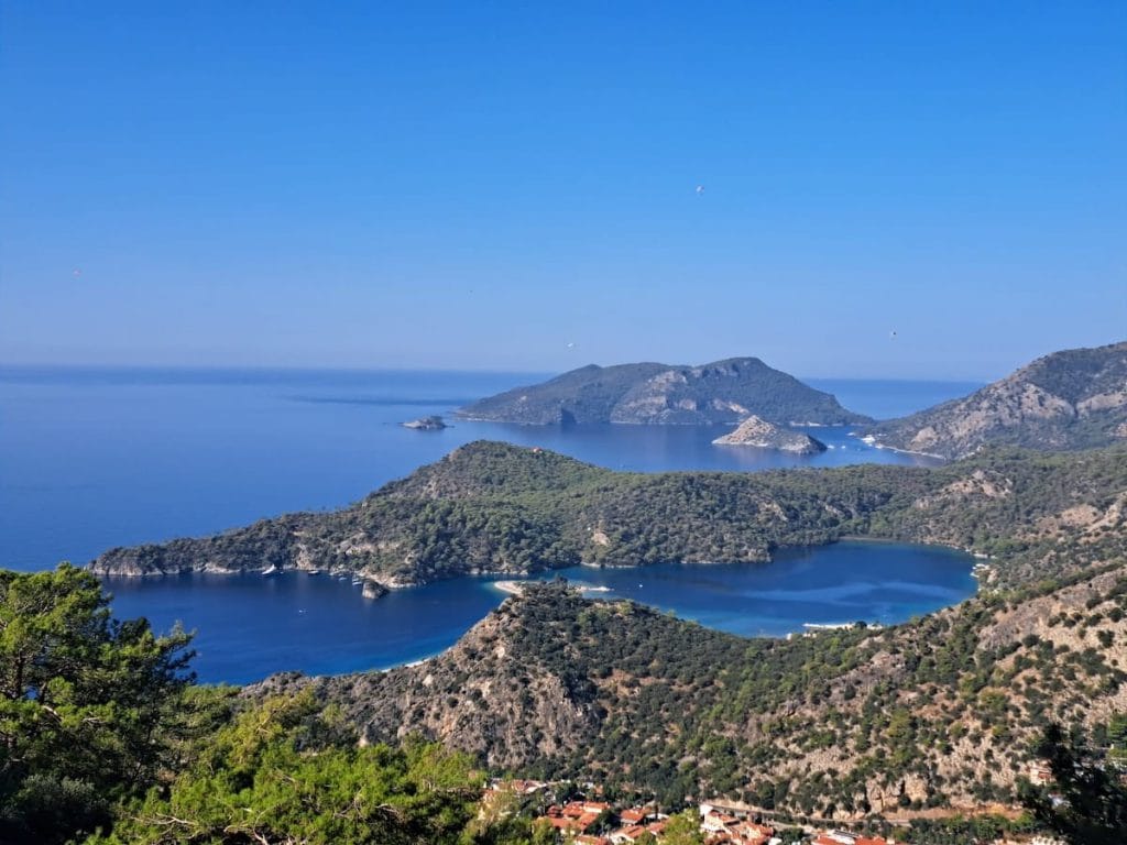
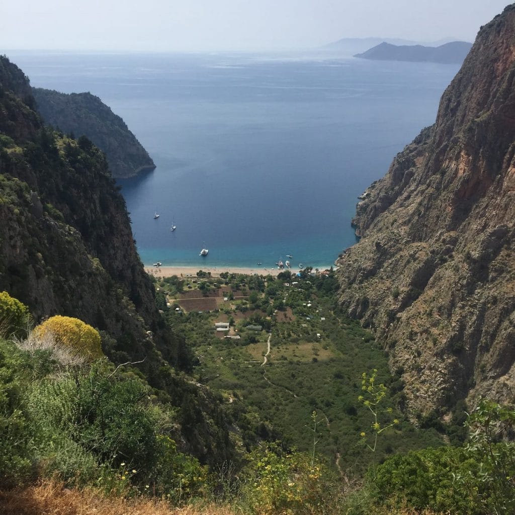
The scenery is the number one thing that draws most hikers, with fantastic coastline views, beautiful mountains, delightful coves, great beaches, and more.
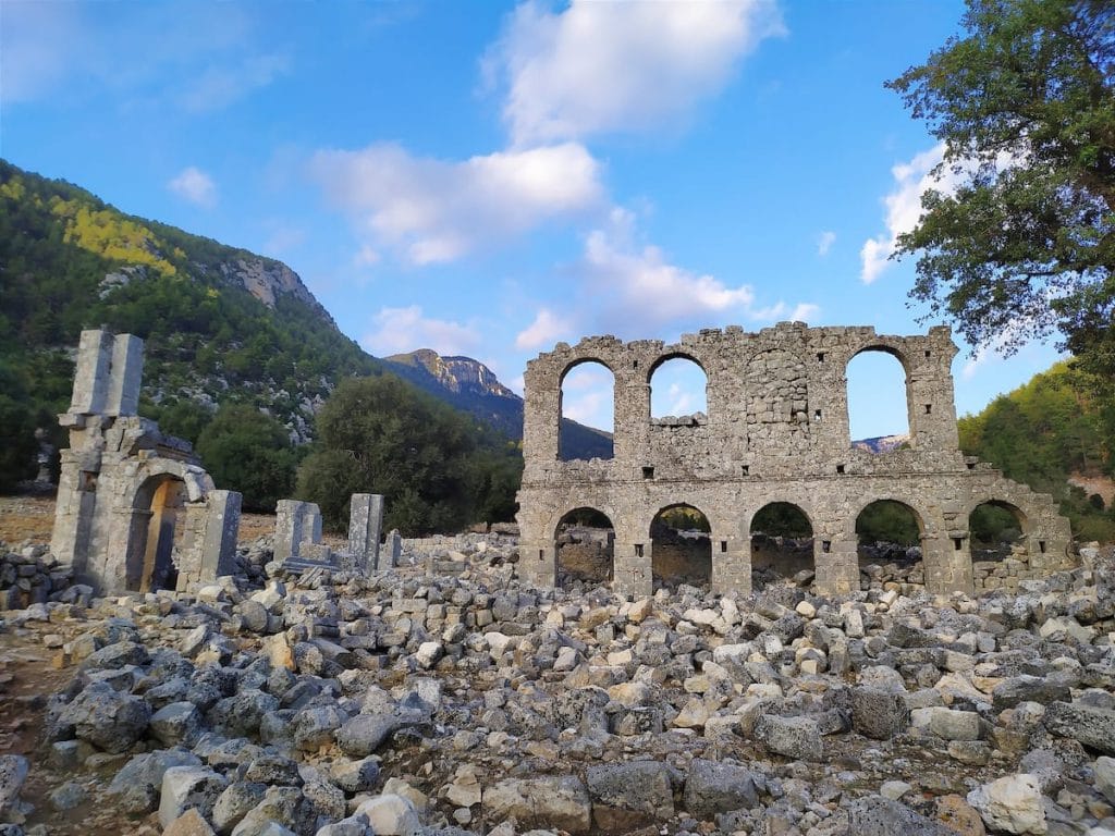
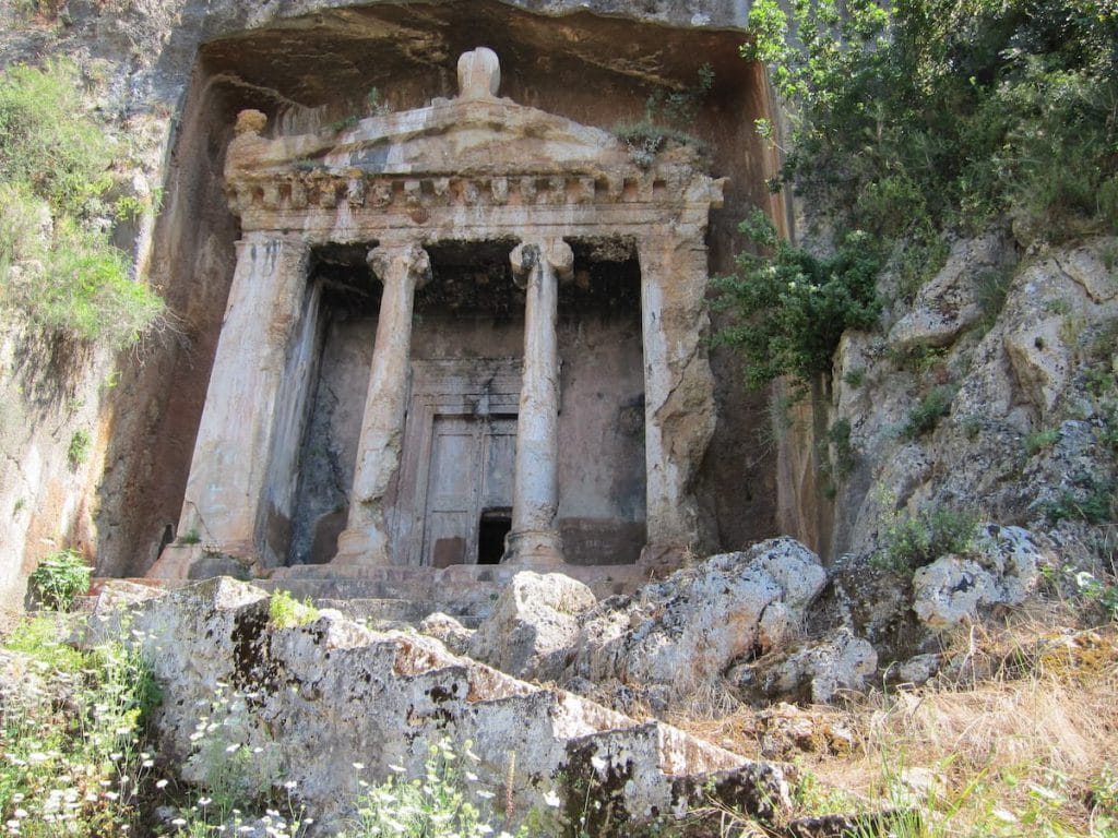
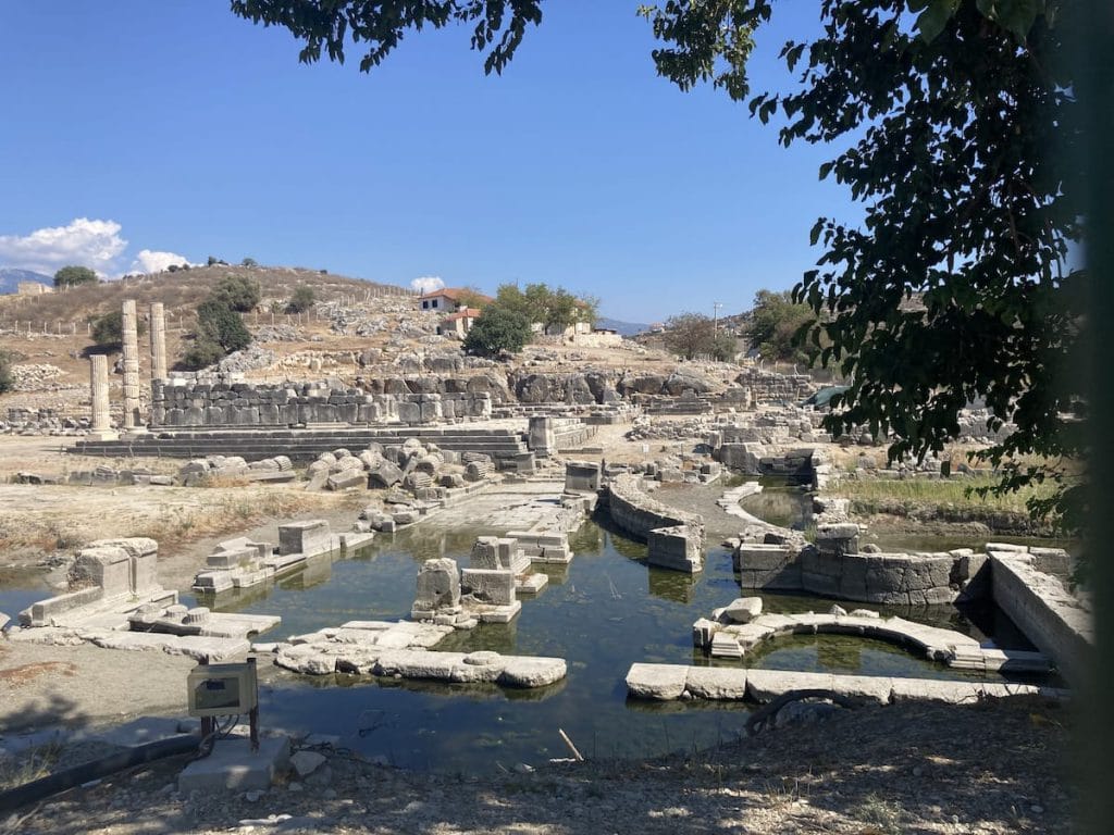
History is also a major attraction, with multiple ancient cities to explore and ruins seemingly everywhere.
The food is incredible and arguably more hikers rave about it than even the scenery!
History is also a major attraction, with multiple ancient cities to explore and ruins seemingly everywhere.
The food is incredible and arguably more hikers rave about it than even the scenery!
Accommodation
Guesthouses: The Lycian Way is mostly a town-to-town hike making it possible to overnight in guesthouses the entire way other than one 3-day (two nights) remote stretch which can easily be bypassed if camping isn’t an option for you.
Camping: If you prefer to camp, it can be done almost anywhere. Note, though, that sometimes there are restrictions during dry periods when there are high risks of forest fires. Usually commercial campgrounds remain open even during restrictions on wild camping.
Camping: If you prefer to camp, it can be done almost anywhere. Note, though, that sometimes there are restrictions during dry periods when there are high risks of forest fires. Usually commercial campgrounds remain open even during restrictions on wild camping.
See our article on accommodation options / types for more info.
Getting In / Out
To / From Fethiye: Nearest airport is in Dalaman, a little under an hour away. It’s an international airport, though most people seem to pass through Istanbul with a domestic flight to / from Dalaman. There are frequent, inexpensive buses available between the airport and Fethiye though a taxi the entire way is also quite affordable.
To / From Geyikbayırı: Nearest airport is in Antalya, a short local bus (dolmuş) ride away.
It’s also easy to get in / out of the Lycian Way from Kalkan, Kaş, Demre, Çıralı, Göynük, and Hısarçandır, among other locations, if you are doing shorter hikes.
To / From Geyikbayırı: Nearest airport is in Antalya, a short local bus (dolmuş) ride away.
It’s also easy to get in / out of the Lycian Way from Kalkan, Kaş, Demre, Çıralı, Göynük, and Hısarçandır, among other locations, if you are doing shorter hikes.
Public Transportation
Dolmuş: Local bus service, called dolmuş, is typically via small mini-van-type vehicles that run within and between most communities along the Lycian Way. In addition to catching a dolmuş at designated stops / stations, it is also possible (and common) to simply wave them down along the major roads. Dolmuş service is typically frequent, cheap, and convenient.
Coach Service: For transit elsewhere in Turkey, coach service is available from bus stations in the major communities. Standards are typically excellent, costs are reasonable, and the coverage map is superb.
Coach Service: For transit elsewhere in Turkey, coach service is available from bus stations in the major communities. Standards are typically excellent, costs are reasonable, and the coverage map is superb.
Getting Around by Car
Private Car: Don’t be shy about asking your guesthouse operator if they can arrange a ride – they inevitably have a relative around somewhere who is happy to earn a bit of cash driving you around. You can also ask in villages at the mosques, markets, or simply on the street. Be prepared to bargain.
Hitchhiking: If you are comfortable with it, hitchhiking is easy and common. Indeed, if you are standing by a road it is not at all unusual for a Turk to pull over and offer a ride even if you weren’t looking for one. It is usually considered polite to chip in a little to help with fuel costs.
Hitchhiking: If you are comfortable with it, hitchhiking is easy and common. Indeed, if you are standing by a road it is not at all unusual for a Turk to pull over and offer a ride even if you weren’t looking for one. It is usually considered polite to chip in a little to help with fuel costs.
Explore
Dig deeper into the Lycian Way with the following sub-pages.
Regions & Trail Sections
Pre-Defined Routes
Coming Soon!
Communities
Highlights & Attractions
Coming Soon!
Accommodations
Tip: See the individual trail section and community entries for accommodation listings specific to that entry.
Pros & Cons
Here’s what jumps out to us about the Lycian Way…
Articles / More Info


Pretty Pictures
Sometimes nothing beats a good photo. Or even a bad photo! If you’d like to share some or all of your photo collection with the Trekopedia community, contact us at photos@trekopedia.com and we can arrange a transfer of them. And thanks!
All photos are copyright by their respective owners and are used with permission.

How You Can Help
Trail research is never actually done. For this overview page for the Lycian Way, here’s some of what we’re looking for (in addition to the general requests for help listed in this article):
Able to help? Contact us!